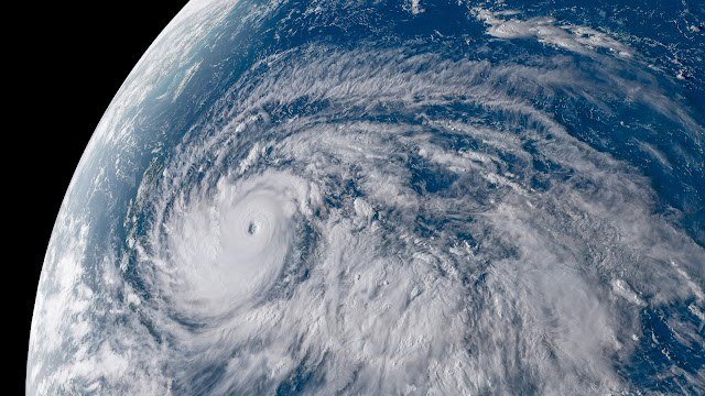
A powerful Pacific storm is bearing down on the northern Philippines. The state weather bureau PAGASA said Monday that Tropical Cyclone Champi maintained its strength moving west-northwest over the sea west of Guam, packing maximum sustained winds of 175 kilometres per hour and gusts of up to 215 km/h.
Champi is expected to strengthen on Monday evening and reach super typhoon status, with maximum sustained winds exceeding 185 km/h. By Monday afternoon, advisories placed the storm about 1,515 kilometres east of southeastern Luzon with a central pressure of 940 hectopascals and tropical cyclone-force winds extending up to 720 kilometres from its centre.
The typhoon is forecast to enter the Philippine Area of Responsibility on Tuesday morning or early afternoon, when it will be given the local name Rosal as the country's 18th tropical cyclone this year. PAGASA said storm wind signals are likely to be raised over the northern and eastern portions of Northern Luzon and parts of the Bicol Region by Monday evening or Tuesday morning, with Signal Nos. 3 and 4 possible — Signal No. 4 carrying a severe threat to life and property.
Gusty conditions over most of Luzon, the Visayas and Mindanao are expected to begin Wednesday, with heavy rains forecast for extreme Northern Luzon. PAGASA said it will issue a dedicated weather advisory on the rainfall threat as Champi continues its west-northwest track before turning northwest later in the week.