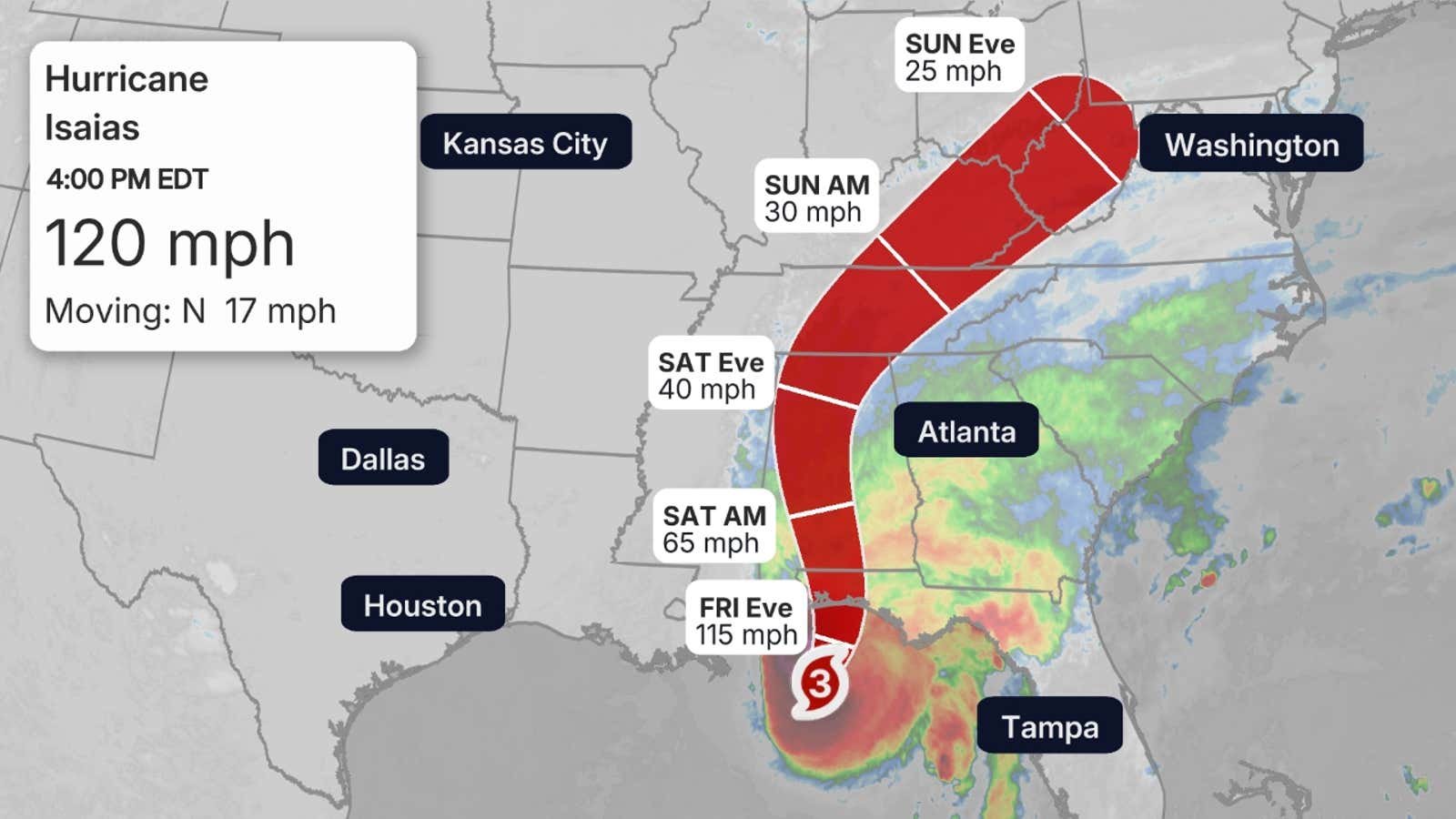
Hurricane Isaias has strengthened into a Category 3 major hurricane and is barreling toward a dangerous landfall tonight along the northern Gulf Coast near the western Florida Panhandle, the National Hurricane Center said Friday. An Air Force Reserve Hurricane Hunter aircraft flew into the storm Friday morning and found maximum sustained winds of 120 mph with a minimum central pressure near 959 millibars.
A hurricane warning is in effect from Ocean Springs, Mississippi, to the Bay/Gulf County line in Florida, while a storm surge warning covers the coast from the mouth of the Mississippi River to the Suwannee River. The NHC forecasts the highest water between the Alabama/Florida border and Grayton Beach, Florida, where surge could reach 6 to 9 feet above ground — a life-threatening level. Tropical storm warnings extend well inland across eastern Mississippi, southern and central Alabama and southwestern Georgia.
The agency expects 4 to 8 inches of rain across southern Alabama, the Florida Panhandle, the Big Bend and southwest Georgia, with isolated totals up to 15 inches, along with hurricane-force winds reaching about 100 miles inland. The NHC is warning residents near the storm's path to prepare for long power outages and to leave immediately if under evacuation orders. A tornado watch is in effect for the Florida Panhandle, extreme southwestern Georgia and southeastern Alabama.
Isaias formed Wednesday in the Gulf of Mexico and is the season's first hurricane after an unusually quiet Atlantic season blamed on a strong El Niño. The storm is expected to weaken quickly once inland, losing its tropical characteristics over northern Alabama before crossing the Tennessee and Ohio valleys as a remnant low on Sunday.